The Route.


ABOVE: This map shows the path of the Dyke Railway as it branches off from the South Coast Mainline and curves round into what is now the Knoll Estate. The approximate path of the line is shown in red. As the estate was developed while the railway line was still very much in operation, the boundaries are very definite and it is easy to determine where the path of the line ran through.


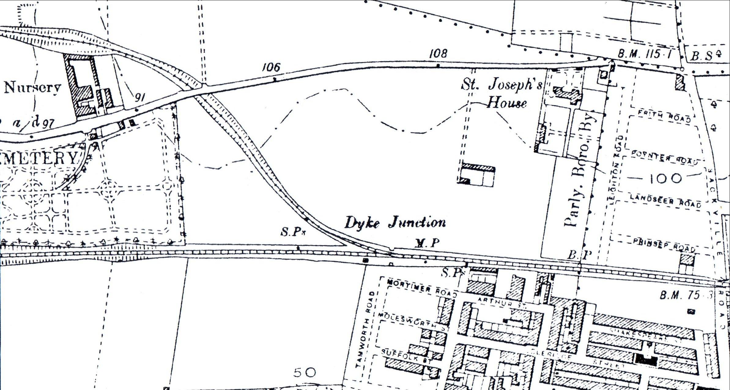
ABOVE: The map shown above dates from 1899 and shows the path of the Dyke Branch and some of the surrounding area in greater detail. Sackville Road can be seen at the extreme bottom right edge of the map. St. Joseph’s house (just right of centre) was a home for blind ex-servicemen and existed up to the early 1990’s when it was demolished in order to make way for the industrial estate of the same name. A Sainsbury's Homebase store and an Ambulance Station stand on the site in the present day.


 The route of the line can still be followed fairly easily in places as the bulk of the route was constructed to serve the housing estates during their construction. This being the case, there is still space in which the original track bed used to run, albeit pressed into other uses.


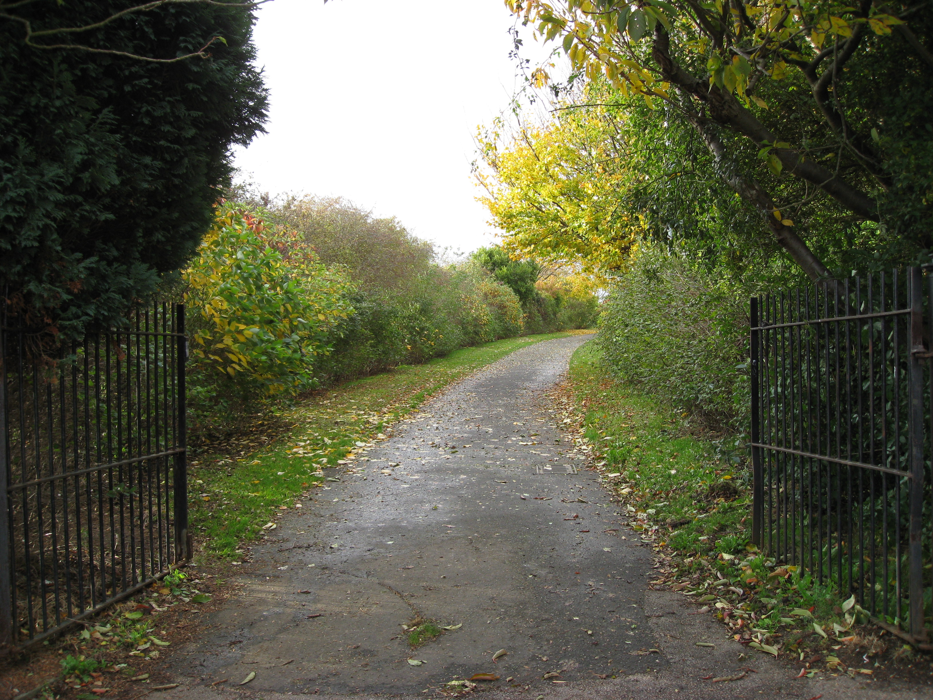
ABOVE: This photo shows the path of the line in the present day looking roughly North, as it curves round behind houses in Rowan Avenue. It has now been made into a path which leads to Knoll Recreation Ground. This is a good thing because (as has been mentioned in the main text) it makes the route of the Dyke Railway remarkably easy to follow along the bulk of its route. The majority of the route has thankfully been preserved as a Cycle Path. photo by Geoff Marshall 


 From its start point at Aldrington Halt, the line branched off due north-west from the South Coast Mainline between the tops of  Rutland Road and Tamworth Road and ran behind the gardens of Amherst Crescent and ran through the site of what is now Sussex House Business Park. It then passed under the Old Shoreham Road between the present petrol station (Frosts) and PC World and immediately to the west of the alley that leads to Maple Gardens, also through the area where the fire station now stands.


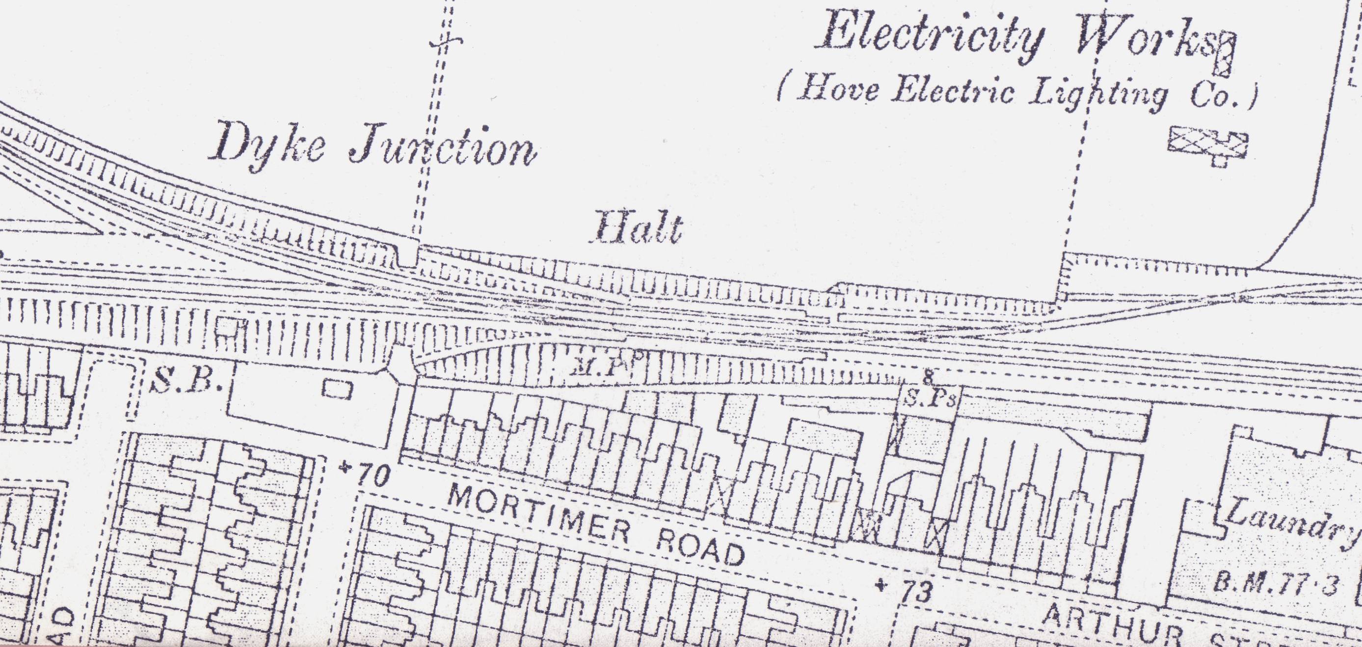
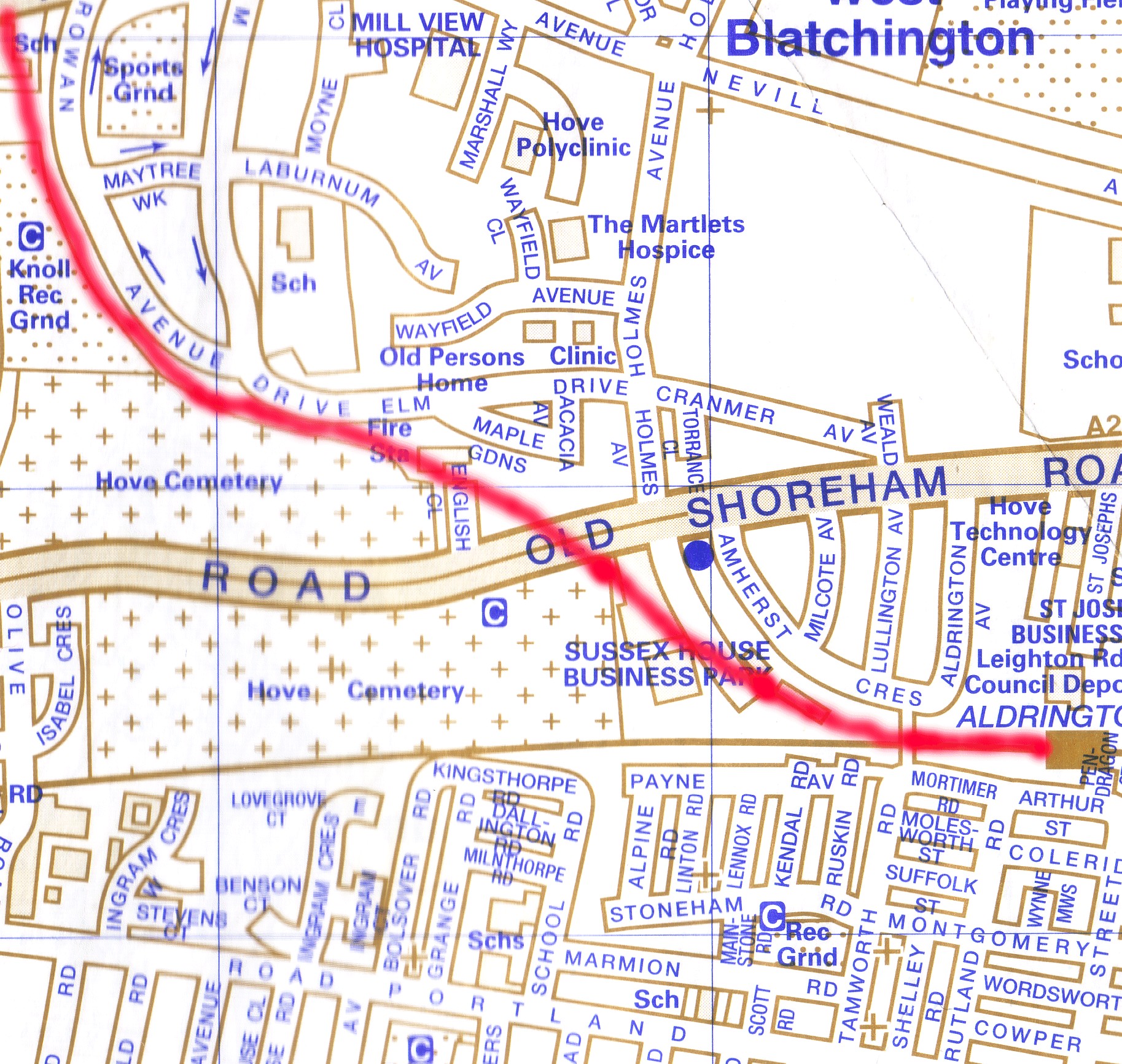
ABOVE: This map shows the junction of the Dyke Railway with the South Coast Main Line. Mortimer Street and its junction with Tamworth Road can be seen where the “+70” mark is, just left of the centre of the map. The Electricity Works is now Homebase, an ambulance station and the St. Joseph Business Park in the present day, just off Shoreham Road.

CLICK HERE to see an aerial view of the Dyke Junction


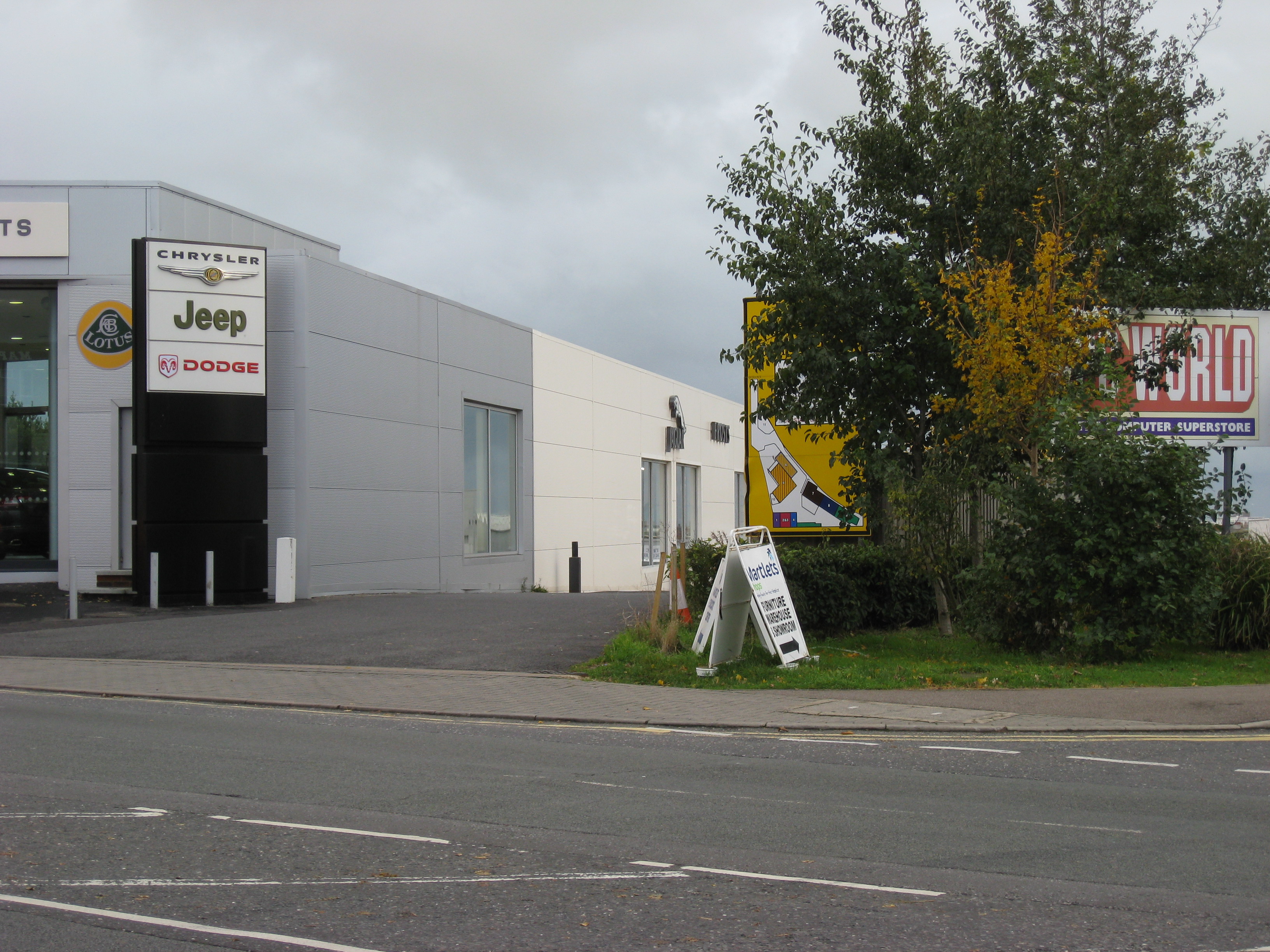
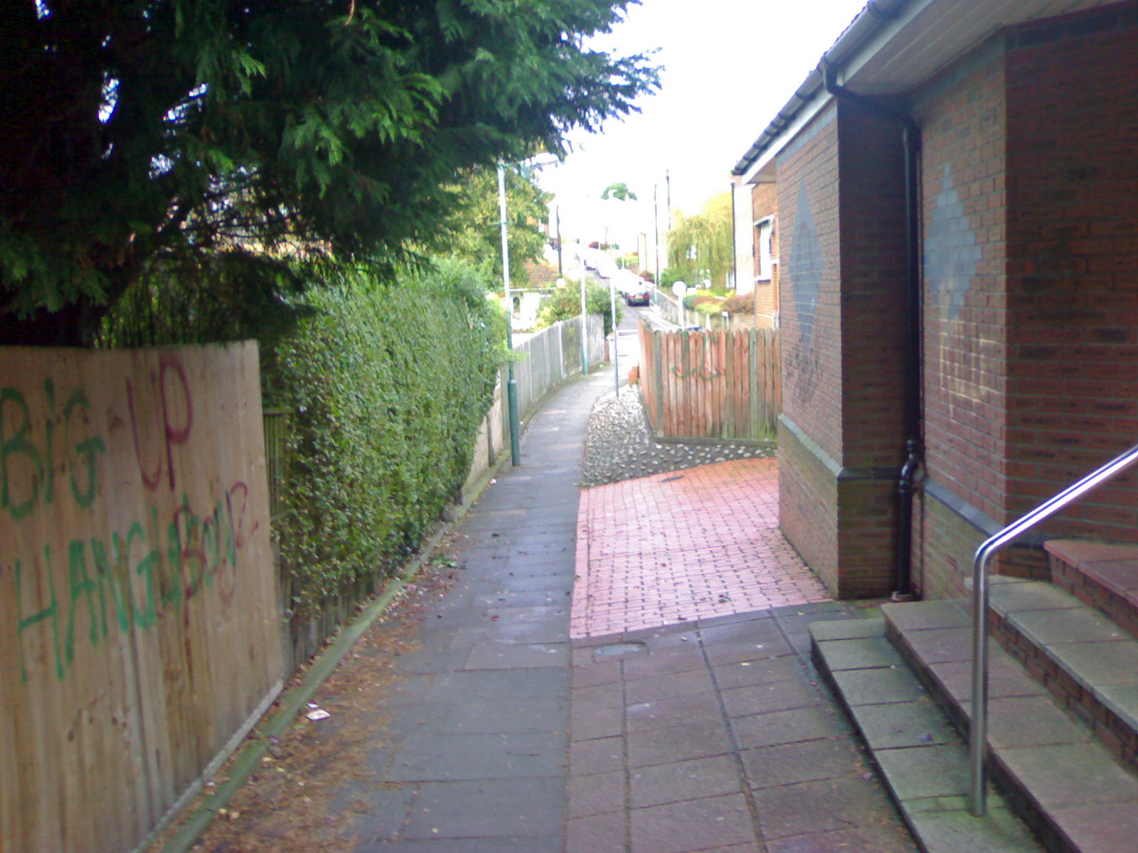
ABOVE: Although this may appear to be something of a strange and peculiar photo at first view (sorry Geoff!) it is in fact very important, because it pinpoints the exact spot through which the Dyke Railway ran before it went through the bridge under Shoreham Road (nice one Geoff!) The building on the left is Frost's Garage and to the right is the Sussex House Business Park, where PC World is. On the other side of Shoreham Road, the track went through the sites of the fire station and the back of the cemetery in the present day.
photo by Geoff Marshall


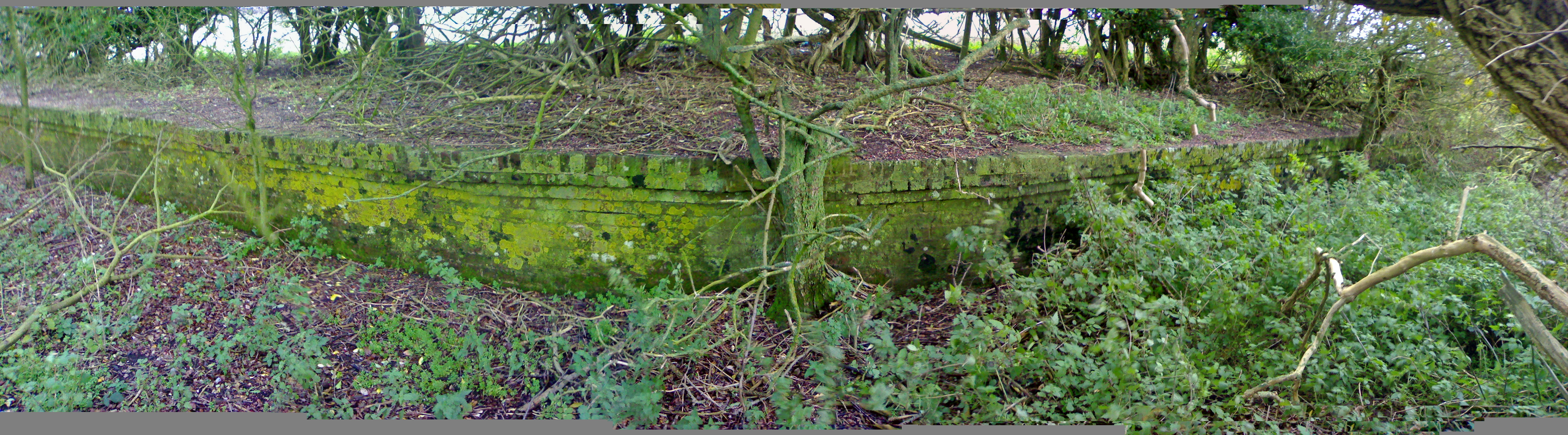
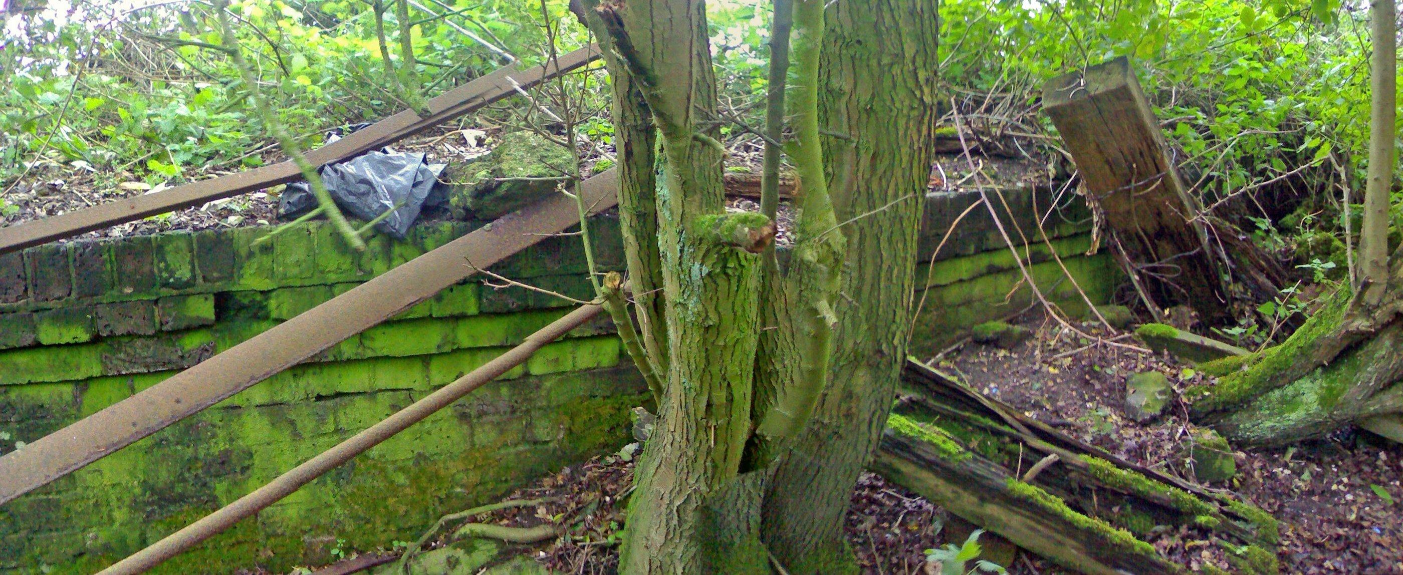
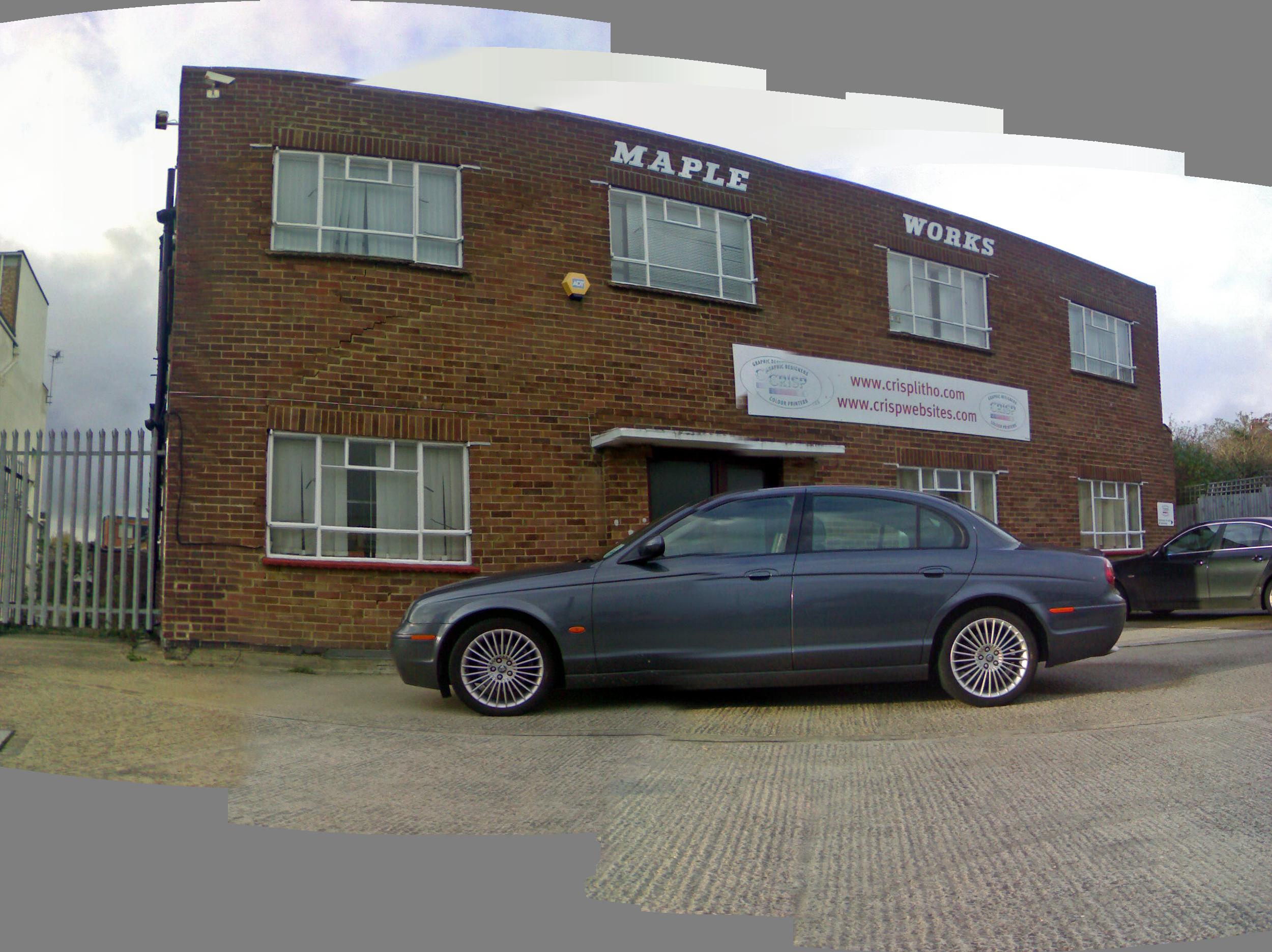
BELOW: This photo shows a panoramic view of the Maple Works building. This building sits diagonally opposite the Frosts Garage, on the other side of Shoreham Road and the Railway passed in a cutting right through the middle of this building. Whilst there are some "glitches" in the photo (it is about 8 photos strung together), there are some pretty astonishing cracks in the building, for example between the two windows on the left of the building. These have occured because it was built on top of land fill when the cutting was filled in, which has since subsided and allowed the building to drop, alarmingly! The majority of the cuttings were filled with old WW2 anti-tank blocks taken from the beaches.


 From here the line continued behind Maple Gardens and Elm Drive along what is now the eastern edge of the cemetery, marked by a hawthorn hedge. At the junction of Elm Drive and Rowan Avenue, a gap between the houses (still a footpath in the present day) leads to the site of Rowan Halt immediately to the north. The halt was an important selling point and also enabled residents working in Brighton or Hove to return home for their cooked meal at lunchtime.


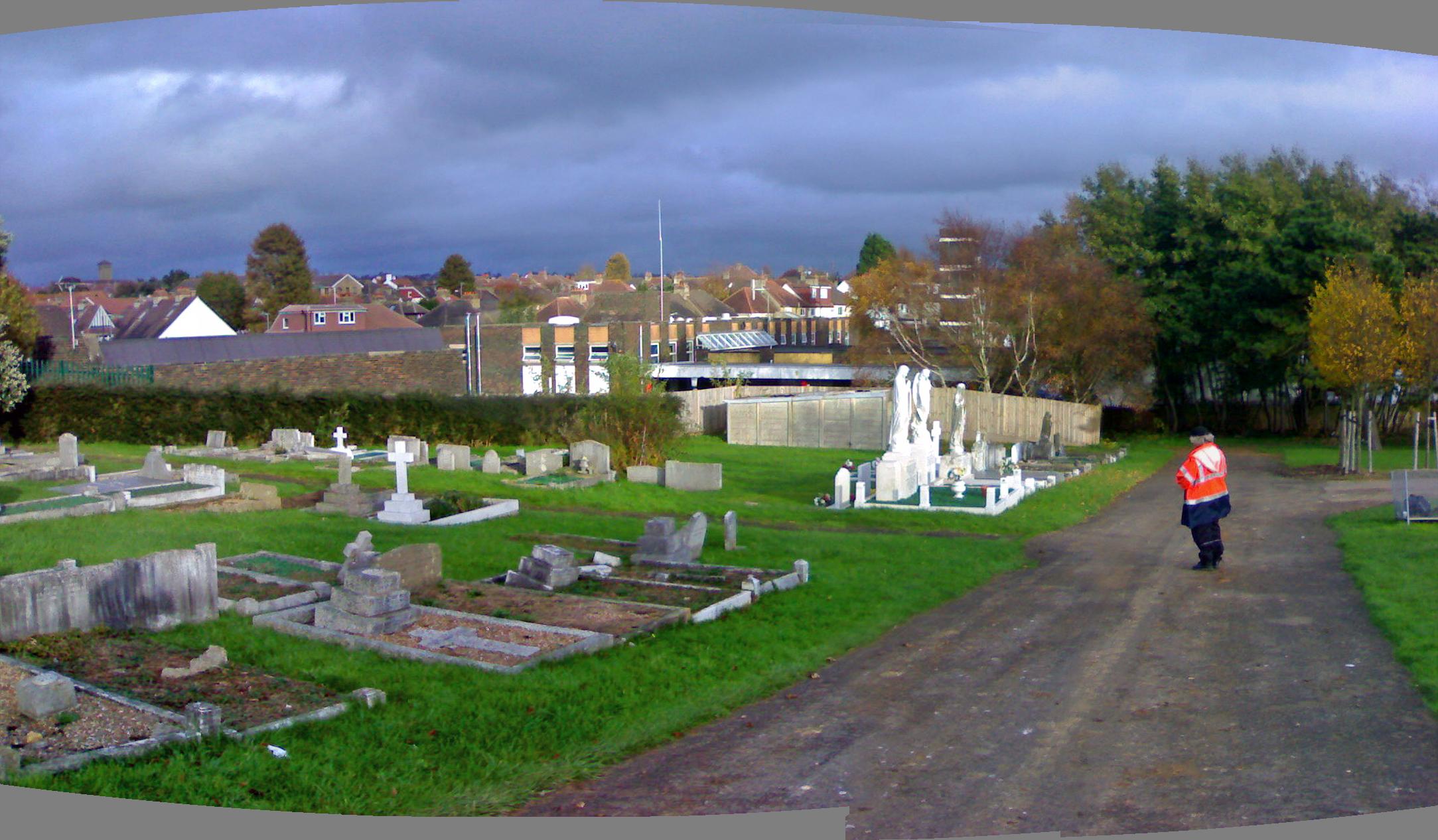
ABOVE: This photo shows the Eastern corner of Hove Cemetery and the Fire Station (in the centre of the picture). The hedge at the left of the picture marks the edge of what was the top edge of the cutting which the railway ran through, the Firestation is actually on the path of the Railway line. Note also Geoff, in deeply contemplative pose!

Footnote: Yes Loz, it was indeed a very contemplative pose; whilst you were taking this photo I had just realised that we were heading toward the very spot I had watched an elder brother of mine laid to rest just a few weeks earlier. His grave is beneath the trees at the extreme right of the picture. - Geoff.

BELOW: Another wide angle shot of the Cemetery. The path of the Railway is denoted by the line of trees at the back of the Cemetery. It is hard to tell from the curve of the photo, but the left side of the photo is oriented towards due North, looking towards the Knoll Recreation Ground and the rear of Rowan Avenue (left side of photo) and the bottom half of Elm Drive (to the right of the photo).


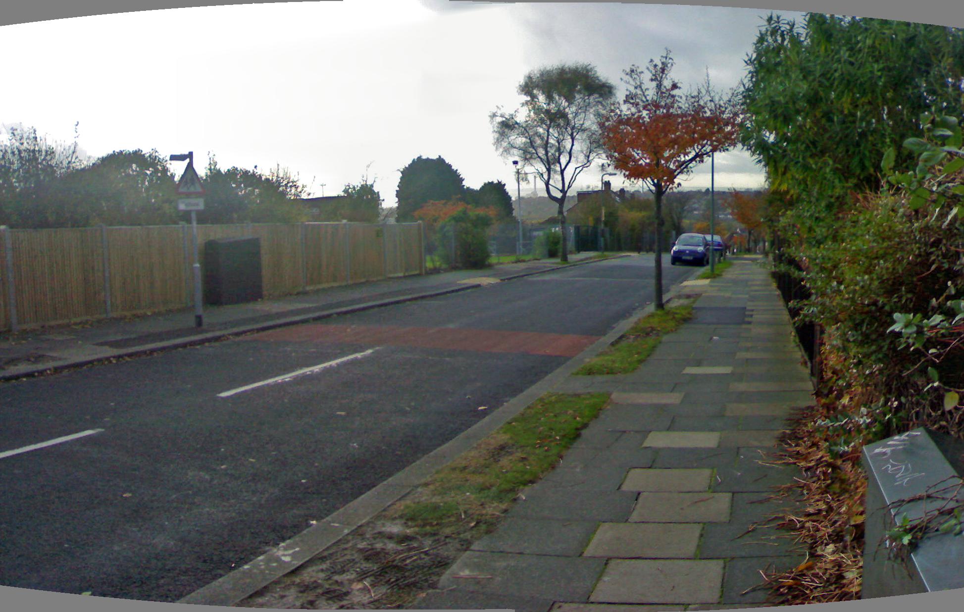
 The line continued up behind Rowan Avenue and through the modern day Knoll recreation Ground, before crossing Hangleton Road on a girder bridge. The road originally dipped below the track, but was filled level in 1945-46. The point of where the bridge stood is at Churchill House and an alley by the side leads to West Way, which was also crossed by a bridge where the library and Kingston Close now stand.

ABOVE: This photo shows the view looking across Hangleton Road. The flats to the left of the photo are Churchill House and they stand on what was the Northern end of the Railway Bridge over Hangleton Road. The road originally dipped under the railway bridge, but was filled level in 1945-46. It is hard to determine the topography of the site from the photo because of infill, but the slope of the little twitten down towards Westway and the Grenadier area of Hangleton hints that there was a raised section on this spot, between 2 bridges, one over Hangleton Road and the other crossing Westway.

CLICK HERE to see a picture of the Hangleton Road Railway Bridge
CLICK HERE to see how it looked when the new Hangleton Road was built

ABOVE & BELOW: These two photos show the Twitten that runs between Hangleton Road and Westway. The path of the Railway would have taken it through the new houses on the far side of Hangleton Road (centre of top photo), through Churchill House (both photos) and onto an embankment (which would have been on the site of Churchill House and just in front of it in the bottom photo). The railings behind Geoff are just at the top of what was the eastern slope of the embankment.

ABOVE: This is the view looking in the opposite direction to the photos above, looking out of the Twitten towards Kingston Close. The Doctor's Surgery on the right is almost exactly where the Bridge over Westway would have begun (where the fence is. The building immediately right is a new Surgery built in the 1990's and is at the Northern end of what was an embankment butting up to the Westway Bridge).


 From here the line ran behind the gardens of Poplar Avenue and under a small brick bridge in Northease Drive where the school and Poplar Close now stand. Here an enterprising estate agent invented a never to be built Hangleton Halt. From here, the line continued up to the Downsman Public House at the top of Poplar Avenue, where a footpath follows more or less the alignment, although the levels have been altered, over the Brighton Bypass to the site of Golf Club Halt at map reference TQ 268 093. The site opened in 1891 for the benefit of the Brighton & Hove Golf Club which had itself opened in 1887. It is pleasing to know that the route from The Downsman Pub up to the Golf Club house has been preserved as a very popular cycle path in the present day.


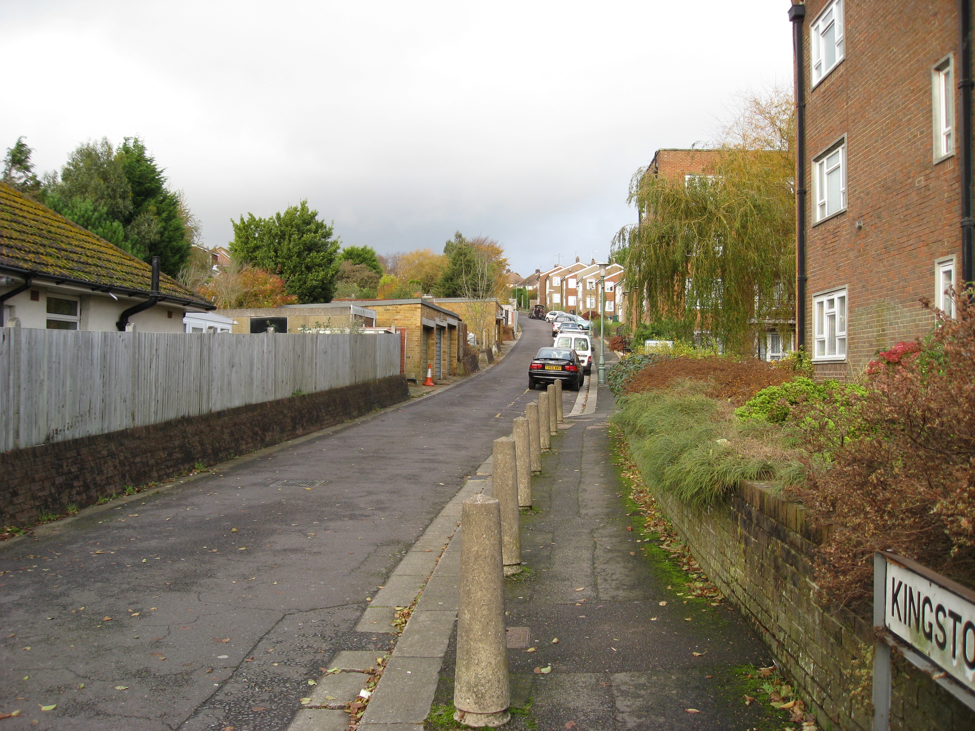
ABOVE: This photo shows Kingston Close, running alongside Hangleton Library. The Library and flats are directly on the path of the Dyke Railway and stand on the Northern edge of the Bridge over Westway and the embankment beyond, seen in the old photographs.

photo by Geoff Marshall


ABOVE: This photo shows the exact position of the Occupational Bridge where the railway would have gone under Northease Drive. Hangleton Junior School stands just beyond the fence (see next picture).


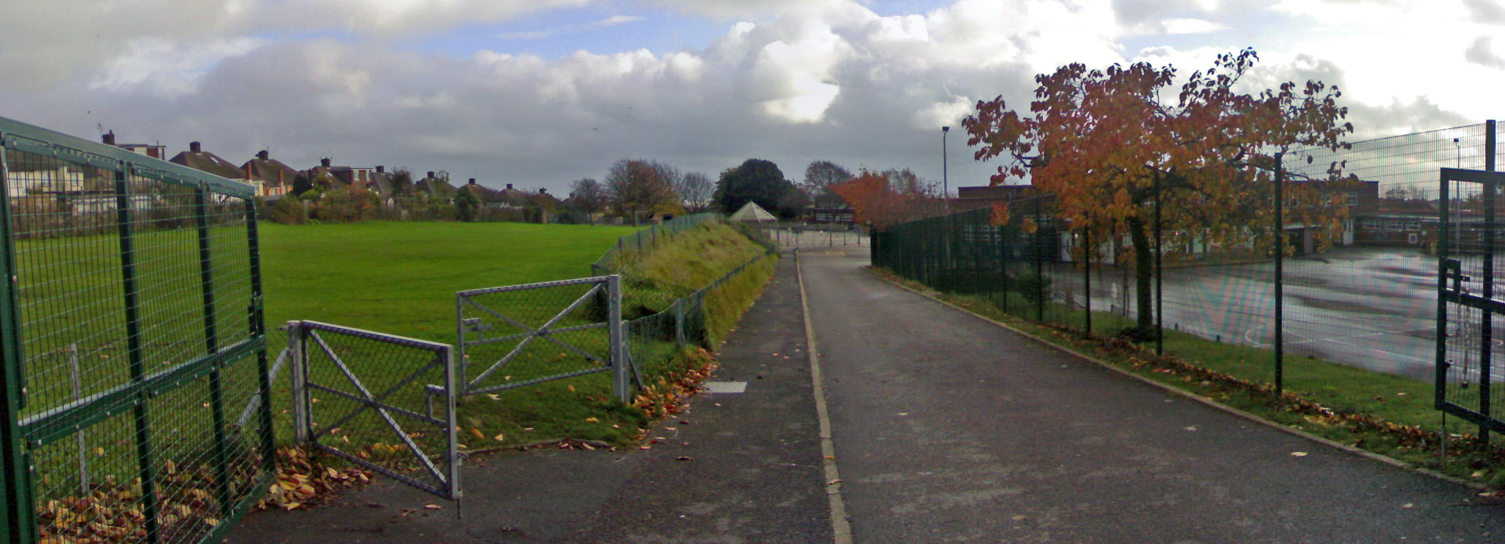
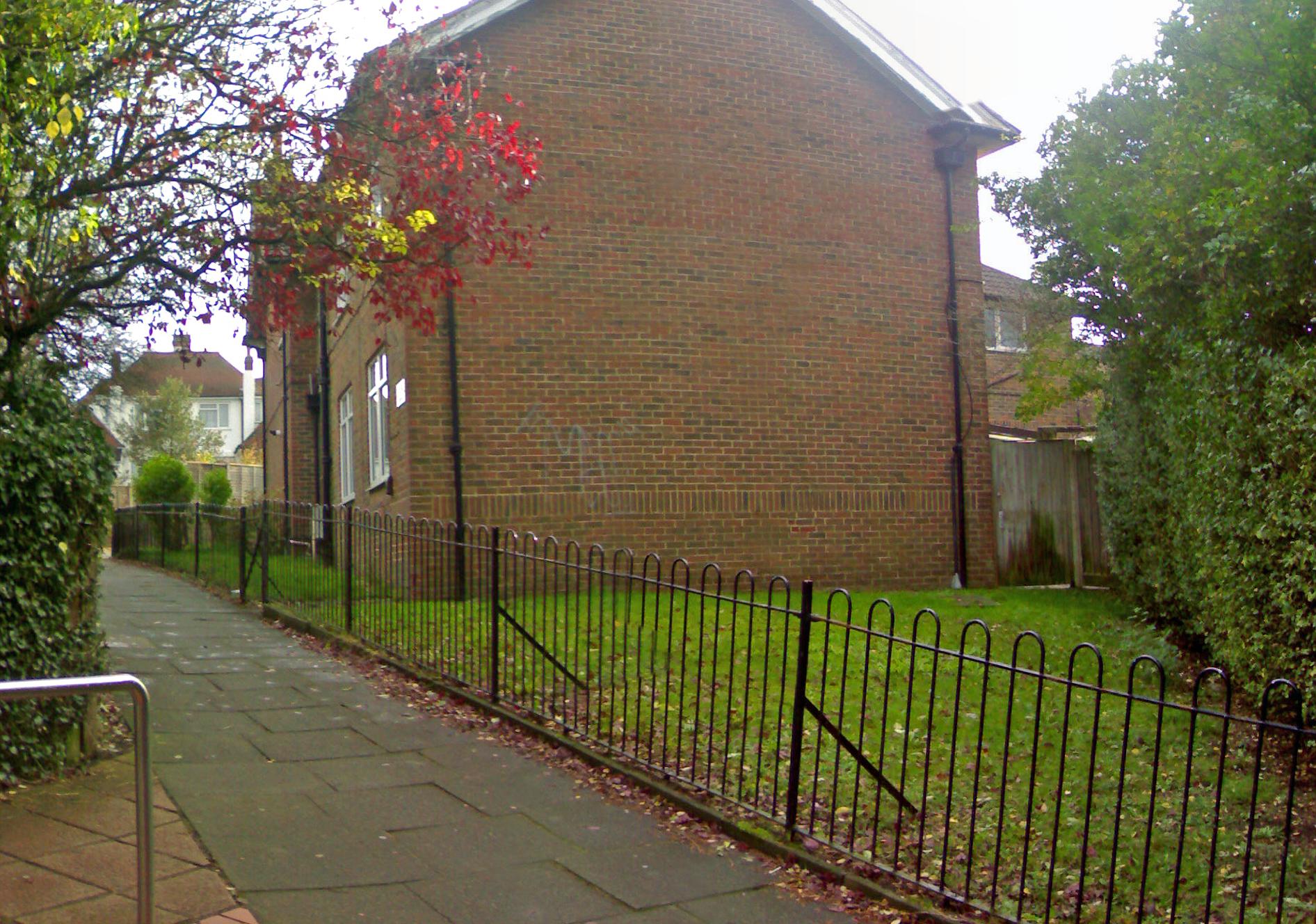
ABOVE: This photo shows the grounds of Hangleton Junior School, looking roughly South. The grass area on the left of the photo is built on what was an embankment, where the railway dropped in order to pass under the Occupational Bridge at Northease Drive


ABOVE & BELOW: The Dyke Railway Trail is where the Dyke Branch becomes truly a suburban route. Just opposite the top of Poplar Avenue, The Railway would have started to wend its way through the hills on its ascent to Devil's Dyke. This point is identified by a pub called The Downsman, which stands on what is now Hangleton Way.

photo owned by Ruth Tyrell and taken from Ruth's Beer Sampling Record (copyright control applies)


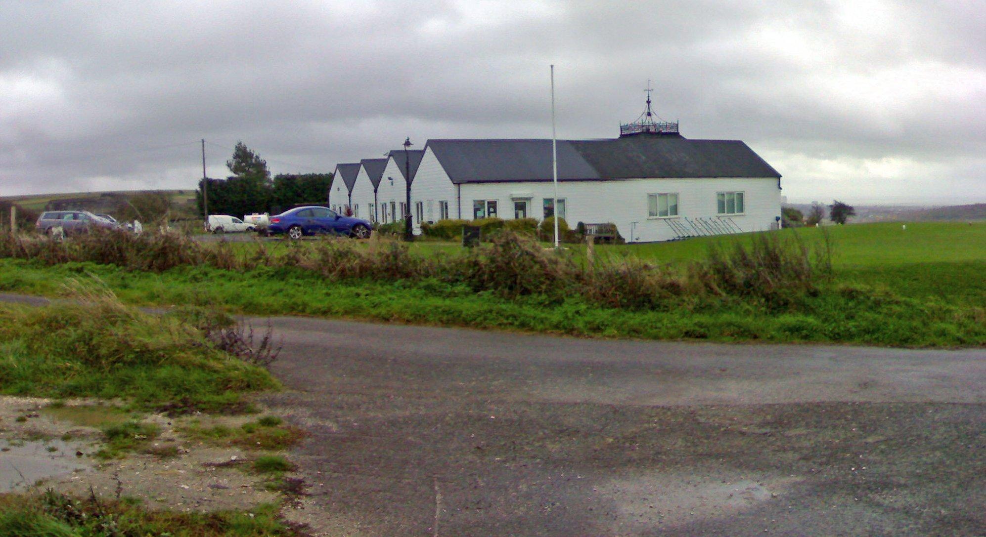
 By 1895 an arrangement had been made so that when the starting signal at Dyke Station was lowered a bell rang in the Golf Club house allowing golfers to quickly finish their drinks and hurry to the platform!

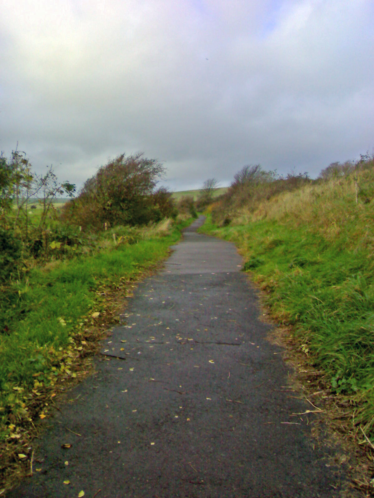
The site of the platform can still be determined in the present day although most of the brickwork and any outbuildings have since long gone. There is no right of way northwards as the remainder of the route is now predominantly running through farmland. However, the route can be discerned and the Dyke Station was to the east of the double fronted building in the distance at map reference TQ 260 103.


ABOVE: The Golf Club house, of Golf Club Halt fame.


ABOVE & BELOW: The platform of Golf Club Halt is in fantastic condition, although well hidden by saplings and scrub. Almost the whole of the platform can be seen close to, but it is quite difficult to get to. The platform sits in an area of bushes on Golf Club Farm which, we were told, has a rather hostile farmer. Geoff and I would have just pleaded ignorance if we were caught, which surprisingly we weren't, seeing as Geoff was wearing a luminous orange coat that is clearly visible from outer space. 
 
Although the line has long since closed it is interesting to note that, despite being operated by steam for the duration of its life, the trip to the summit was surprisingly swift. I doubt if a modem car could better the journey time of 20 minutes from the centre of Brighton, especially in the current climate of persistent road works and traffic calming measures, which may slow the traffic, but do little to calm the nerves!