Branch Line:
An Introduction.
It is thought that it gained its name from a local
This begs the question of why he didn’t return to finish the job, but the name seems to have stuck and it could be that the legend has played a significant part in the site’s popularity and doubtless added an air of mystery and romance to the place.
Devil’s Dyke became a very popular tourist destination for Victorian and Edwardian day trippers, the area which the Devil didn’t manage to excavate offering magnificent views over the Weald, The Downs and The Sea. In the early years of the Dyke’s popularity, there were excursions up to the Dyke by horse drawn carts, but these were slow and often expensive. A round trip by waggonette from
There was clearly an opportunity for a railway to be built in order to improve travel to the Dyke. The reasons for this were cited as being primarily for excursion traffic, but also when the possibility of housing development around the summit was realised. As a result, the
It was envisaged by the railway company that an estimated annual traffic of some 273 thousand people would visit the site and that there would be at least 10 thousand visitors on Bank Holidays.
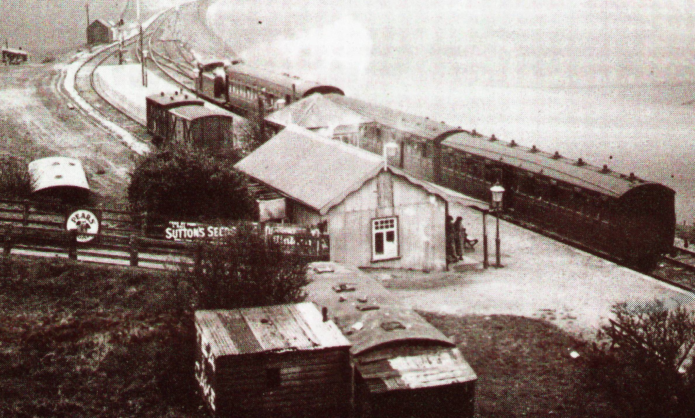
On
Because of its location high in the hills of the
It is hard to tell if this affected the popularity of the site in its early years. On the one hand the site was very popular with holiday makers, but there was never the anticipated flurry of development despite the obvious advantages of rail access. No residences were ever built at the vantage point with the exception of the hotel. However, a number of tourist attractions were built around the site throughout the Dyke’s popularity: a funfair was built, a switchback railway, a funicular railway was constructed on the slope facing the Weald and a cable car railway was built spanning the trench. Also, at some stage of the proceedings, a replica of King Tutankhamen’s tomb was built in the southern side of the trench.
In the same way that the Kemp Town Railway was originally built with no intermediate stopping places along the bulk of its length after London Road Station, the Dyke Branch had no stopping places on its route until the creation of Rowan Halt, which was began on 18th December 1933 and completed 12th January 1934, quite late in the Railway’s relatively short life. Rowan Halt was roughly half a mile from the Branch’s junction with the South Coast Line at Aldrington, situated on the Knoll Estate in Hangleton, between Rowan Avenue Stapley Road
At around the same time, a private “hail and ride” halt was built ¾ mile (roughly 62 chains) from the Dyke Terminus to serve a new golf club nearby. It is interesting to note that after the opening of Rowan Halt, all winter services terminated there, as the only real traffic at that time of year was concerned with the construction of a rapidly developing housing estate in the area around the halt. The line was served from Brighton Station, with trains serving
It is sad to note that by 1932, most people had forsaken the poor railway in favour of cars and buses and this was really deemed the beginning of the end. For some time the powers that be had viewed the Dyke Branch as little more than “an expensive line, little more than a glorified mountain railway, with rapidly diminishing traffic prospects”. The line closed on New Year’s Eve 1938, amid much sadness and melancholia.
